guide -
The Most Beautiful Scenic Drives in California
The most beautiful scenic drives in California include the iconic Pacific Coast Highway through Big Sur, the high-altitude journey of Tioga Road in Yosemite National Park, and the stark, otherworldly landscapes of the Death Valley Scenic Byway. These routes showcase the state's i
The most beautiful scenic drives in California include the iconic Pacific Coast Highway through Big Sur, the high-altitude journey of Tioga Road in Yosemite National Park, and the stark, otherworldly landscapes of the Death Valley Scenic Byway. These routes showcase the state's incredible diversity, offering everything from dramatic coastal cliffs and towering alpine peaks to vast desert basins, ensuring a world-class road trip no matter which direction you point your car.
Welcome to the ultimate road trip state! California isn't just a destination; it's a journey. Its sheer size and geological variety mean that a few hours behind the wheel can transport you between completely different worlds. Imagine starting your day with salty sea spray on a coastal highway, having lunch surrounded by thousand-year-old trees, and watching the sunset paint a desert canyon in hues of orange and purple. This isn't a fantasy; it's a typical Tuesday on a California road trip. Here at Gidly, we live for these experiences, and we've driven, mapped, and explored countless miles to bring you the definitive guide. From the world-famous to the wonderfully obscure, get ready to fuel up, roll down the windows, and discover the most beautiful scenic drives California has to offer in 2026.
The "Big 5": California’s Most Famous & Unforgettable Drives
These are the headliners, the routes that grace postcards and inspire cross-country pilgrimages. California's "Big 5" scenic drives are more than just roads; they are iconic experiences that define the state's natural grandeur. Each one offers a completely unique environment, from the most famous coastline in the world to the highest mountain passes and the lowest, hottest point in North America. Driving any one of these is a bucket-list achievement, but tackling all five is to truly understand the soul of California. Our team at Gidly has driven these routes countless times, in every season, and they never fail to astound. They are popular for a reason, representing the pinnacle of American road-tripping. Be prepared for breathtaking views, frequent photo stops, and the creation of memories that will last a lifetime. These are the essential drives that form the foundation of any California adventure.
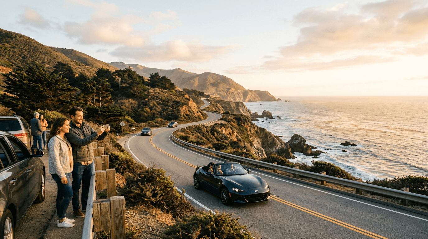
1. Pacific Coast Highway (Highway 1): The Quintessential Coastal Road Trip
When you picture a scenic drive in California, this is almost certainly the one that comes to mind. The Pacific Coast Highway, or PCH, is the undisputed king of coastal routes. While it officially runs for over 650 miles, the most celebrated stretch is the roughly 90-mile section through Big Sur, between Carmel-by-the-Sea and San Simeon. This is where the Santa Lucia Mountains plunge dramatically into the turquoise Pacific, creating a landscape of breathtaking cliffs, crashing waves, and redwood-filled canyons. It's a drive that demands you take it slow, with countless turnouts offering vistas that seem to get better around every hairpin turn. The air is thick with the scent of salt and eucalyptus, and the constant sound of the ocean is your travel companion. From our experience, it's not a route to be rushed; it's an experience to be savored. Plan for a full day, or even better, an overnight stay, to truly soak it all in.
Route Overview & Can’t-Miss Stops
The classic Big Sur drive typically runs from north to south. Starting in Carmel, your first major landmark is the iconic Bixby Creek Bridge, one of the most photographed bridges in the world. Pull over at the Castle Rock Viewpoint on the north side for the classic shot. Continuing south, you'll pass through the heart of Big Sur. Stop at Pfeiffer Big Sur State Park to walk among coastal redwoods. A slight detour will take you to Pfeiffer Beach, famous for its purple sand and Keyhole Rock. The undisputed gem of the drive is Julia Pfeiffer Burns State Park, home to McWay Falls, an 80-foot waterfall that cascades directly onto the beach. It's a short, easy walk from the parking lot to the overlook. Further south, the landscape opens up as you approach the Ragged Point Inn and Resort, often called the "Gateway to Big Sur," offering your last epic cliffside view before the road descends towards San Simeon, home of the famous Hearst Castle.
Best Time to Drive & Duration
The ideal time to drive the Big Sur coast is during the spring (April-May) for clear skies and blooming wildflowers, or in the fall (September-October) for the sunniest, least foggy weather of the year. Summer often brings the "marine layer," a thick fog that can obscure the views, especially in the mornings. Winter can be beautiful and less crowded but carries the risk of rainstorms and potential road closures due to mudslides. We strongly recommend driving from north to south (Carmel to San Simeon). This puts you on the ocean side of the road, giving you unobstructed views and making it much easier and safer to pull into the numerous vista points. While you can technically drive the 90-mile stretch in 2-3 hours, you should budget a minimum of 5-6 hours to allow for stops, photos, and short walks. To make it a truly relaxing trip, consider an overnight stay in one of the rustic lodges or campgrounds in Big Sur.
Insider Tip: Finding Secret Coves and Best Photo Ops
While everyone stops at Bixby Bridge and McWay Falls, the real magic of Big Sur lies in its quieter moments. Just south of the Hurricane Point Viewpoint, look for a small, unmarked turnout. A short, unofficial trail leads down to a secluded bluff with incredible views back towards Bixby Bridge, away from the main crowds. Another local secret is Garrapata State Park, just south of Carmel. Many people drive right by it, but its western side has stunning trails that lead down to hidden coves and beaches that you might have all to yourself, especially on a weekday. For photography, the "golden hour" just before sunset is unmatched. Position yourself at a south-facing viewpoint like Ragged Point to watch the setting sun illuminate the entire coastline in a warm, golden light. It’s a moment of pure California magic that most tourists rushing through will miss.
2. Tioga Road (Highway 120), Yosemite: A Journey Across the High Sierra
If Highway 1 is California's coastal masterpiece, Tioga Road is its alpine equivalent. This 46-mile drive cuts across the heart of Yosemite National Park, climbing to an elevation of 9,943 feet at Tioga Pass, making it the highest vehicle pass in California. It's a journey through a breathtaking high-country landscape of granite domes, pristine alpine lakes, and lush meadows dotted with wildflowers. Open only during the summer and early fall, a drive on Tioga Road feels like a special event. The air is thin and crisp, the scale of the landscape is immense, and the feeling of being on top of the world is palpable. The road connects the western side of the park near Crane Flat with the Eastern Sierra town of Lee Vining on Highway 395. Our team loves this drive for its sheer sense of escape; it takes you far away from the crowds of Yosemite Valley into a wilder, more serene part of the park that many visitors never see.
Route Overview & Can’t-Miss Stops
Driving from west to east, your first major stop is Olmsted Point. This is a must-stop, offering a unique perspective of Yosemite Valley, including the northern side of Half Dome and Clouds Rest. A short walk from the parking lot onto the granite slab reveals the full panorama. Next, you'll reach shimmering Tenaya Lake, a stunning alpine lake perfect for a picnic, a brisk swim, or kayaking on its crystal-clear water. The road then continues to Tuolumne Meadows, a vast, subalpine meadow system that is the heart of the Yosemite high country. Park at the visitor center or Lembert Dome parking area and take a walk along the Tuolumne River. The final ascent brings you to Tioga Pass, the crest of the Sierra. There's a small sign marking the elevation, a classic photo op, before you begin the dramatic descent towards Mono Lake and the Eastern Sierra.
Best Time to Drive & Duration (Understanding Seasonal Closures)
This is critical: Tioga Road is subject to seasonal closures due to heavy snowfall. It typically opens sometime between late May and late June and closes with the first significant snowfall, usually in October or November. Always check the official Yosemite National Park website for current road status before planning your trip. The best time to drive is from July through September when the road is reliably open, the meadows are green, and the weather is generally stable. Driving the 46 miles within the park can be done in about 1.5 hours without stops, but you should allocate at least 3-4 hours to enjoy the viewpoints and perhaps a short hike. Be aware that a park entrance reservation may be required, especially during peak summer months, so plan ahead.
Insider Tip: Acclimatize and Watch for Thunderstorms
The high elevation is no joke. If you're coming from sea level, take it easy on your first day. Drink plenty of water to stay hydrated and avoid strenuous activity until you've acclimatized. Headaches and shortness of breath are common signs of mild altitude sickness. Also, the High Sierra has a monsoonal weather pattern in the summer. Mornings are typically clear and beautiful, but clouds can build rapidly in the afternoon, leading to dramatic (and sometimes dangerous) thunderstorms with lightning. Plan your longer hikes and exposed viewpoint visits for the morning. If you see dark clouds gathering, it's best to head back to your car. The storms usually pass quickly, often leaving behind a spectacular, freshly washed landscape.
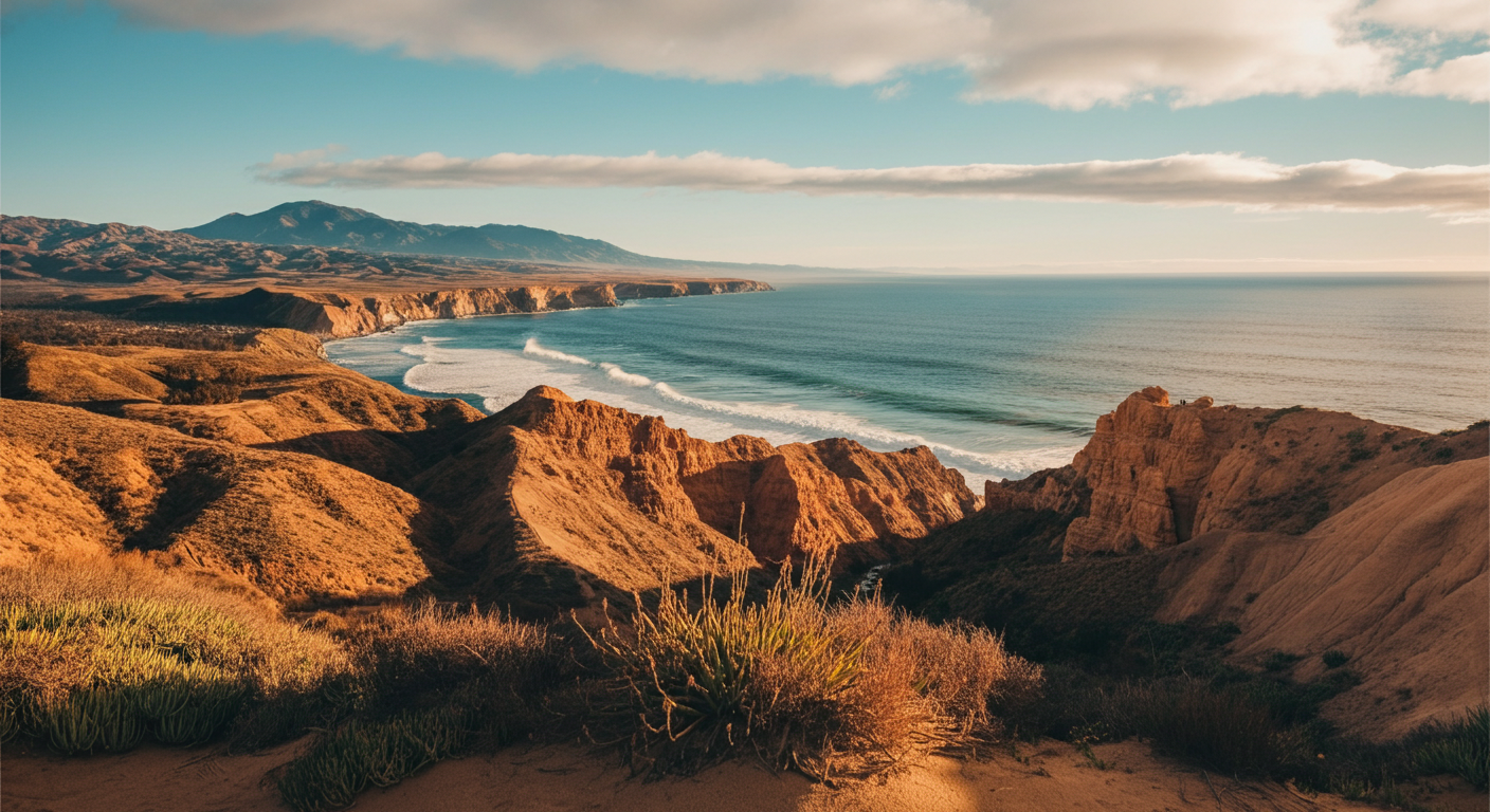
3. Death Valley Scenic Byway (Highway 190): A Beautiful Land of Extremes
Prepare to have your perception of the desert completely transformed. The Death Valley Scenic Byway is a journey into a landscape of stark beauty and geological wonder. This is a place of superlatives: the hottest, driest, and lowest place in North America. Driving Highway 190 through Death Valley National Park reveals a world of sculpted badlands, vast salt flats, towering sand dunes, and canyons painted with impossible colors. The sheer scale and silence of the place are humbling. While the summer heat is dangerously extreme, visiting in the cooler months reveals a surprisingly vibrant and welcoming environment. We at Gidly consider this one of the most profound driving experiences in the state, a place that feels more like another planet than a part of California. It’s an adventure that requires preparation but rewards you with unparalleled solitude and otherworldly beauty.
Route Overview & Can’t-Miss Stops
The main artery through the park is Highway 190. Entering from the east, one of the first essential stops is Zabriskie Point, offering a panoramic sunrise view over the golden-hued badlands of the Furnace Creek formation. Continuing west, a short detour on Badwater Road takes you to two iconic spots. First is the nine-mile, one-way Artist's Drive, a paved loop through colorful mineral-stained hills, with the highlight being the vibrant Artist's Palette. Further south on this road is Badwater Basin, the lowest point in North America at 282 feet below sea level. Walk out onto the vast salt flats for a truly surreal experience. Back on Highway 190, don't miss the Mesquite Flat Sand Dunes near Stovepipe Wells, especially at sunrise or sunset when the low-angle light creates dramatic shadows on the dunes. The scale here is immense, so give yourself time to explore.
Best Time to Drive & Duration (Why You Should Visit in Winter or Spring)
Let's be clear: do not attempt to extensively tour Death Valley in the summer. From June to September, daytime temperatures consistently exceed 120°F (49°C), which is dangerous for both you and your vehicle. The absolute best time to visit is from November to March when temperatures are mild and pleasant, perfect for driving and hiking. An added bonus for visiting in the late winter and spring (especially after a wet winter) is the chance to see a spectacular wildflower bloom, a rare and beautiful phenomenon. Driving across the park on Highway 190 takes about 2-3 hours, but to see the main highlights, you'll want to dedicate a full day or, ideally, two. Staying overnight in the park allows you to experience the incredible stargazing and the magic of sunrise and sunset in the desert.
Insider Tip: Sunrise at the Dunes and Gas Preparedness
While Zabriskie Point is famous for sunrise, the experience at the Mesquite Flat Sand Dunes is arguably more magical. Arrive about 30 minutes before sunrise and walk deep into the dunes, away from the parking lot. Find a high dune to sit on and watch as the first light hits the distant mountains and then slowly creeps across the sand, creating a breathtaking spectacle of light and shadow. It's an incredibly peaceful and photogenic experience. On a practical note, gas is extremely limited and expensive in the park. Fill up your tank in Pahrump or Beatty (Nevada), or Lone Pine or Trona (California) before entering. There are gas stations at Furnace Creek and Stovepipe Wells, but you'll pay a significant premium. Always carry extra water in your car, no matter the season.
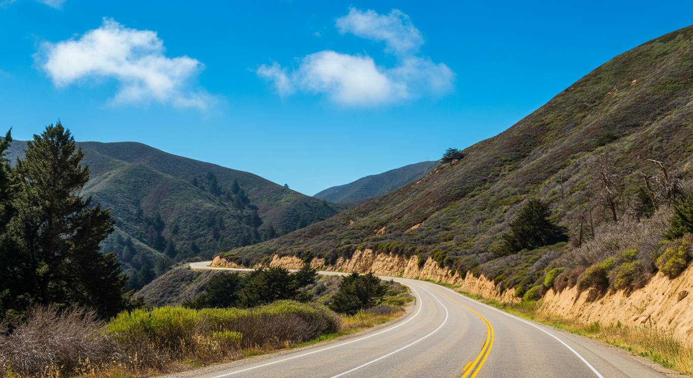
4. Avenue of the Giants: Driving Through a Redwood Wonderland
Step into a world of giants. The Avenue of the Giants is a serene, 31-mile scenic alternative to Highway 101 in Northern California's Humboldt County. This road winds its way through the heart of Humboldt Redwoods State Park, home to the largest remaining stand of old-growth coast redwoods on Earth. Driving this route is a truly humbling experience. Sunlight filters down through the colossal canopy, dappling the road in a soft, ethereal light. The air is cool, damp, and smells of rich earth and pine. It’s a drive meant to be taken slowly, with windows down and neck craned upwards in awe. Unlike the grand, sweeping vistas of the coast or mountains, this drive is intimate and immersive, making you feel small in the best possible way. Our team considers this a mandatory stop for anyone traveling in Northern California; it’s a living, breathing fairy tale.
Route Overview & Can’t-Miss Stops
The road is dotted with groves, trails, and quirky roadside attractions. A great first stop is the Humboldt Redwoods State Park Visitor Center near Weott, where you can get maps and advice from rangers. One of the most popular photo ops is the Shine Drive-Thru Tree in Myers Flat (note: there is a small fee). While a bit touristy, it's a classic redwood experience. For a more natural immersion, stop at the Founders Grove and take the short, accessible loop trail to see the Dyerville Giant, a fallen 362-foot behemoth. Another essential stop is the Rockefeller Forest, accessed via Mattole Road. This grove contains some of the most impressive trees in the park and feels truly primeval. The road itself is the main attraction, so be sure to pull over at the many unmarked turnouts to simply stand and marvel at the scale of these ancient beings.
Best Time to Drive & Duration
The Avenue of the Giants is a wonderful drive year-round. Summer offers warm weather and the best chance of sunshine filtering through the trees. Spring brings lush green foliage and blooming rhododendrons. Fall sees fewer crowds and a peaceful atmosphere. Even winter has its own moody charm, with mist and fog weaving through the giant trunks, though you should be prepared for rain. Driving the 31 miles straight through would take less than an hour, but that would defeat the purpose. Plan for at least 2-4 hours to allow for multiple stops, a short hike or two, and plenty of time for photos. The pace here is slow and contemplative, a welcome break from the faster-paced Highway 101 running alongside it.
Insider Tip: Pack a Picnic and Hike the Rockefeller Loop
Services along the Avenue of the Giants are very limited. There are a few small towns like Miranda and Myers Flat with basic amenities, but your best bet is to pack a picnic lunch. There are numerous beautiful spots to stop and eat amongst the giants, such as the Williams Grove Day Use Area. For the most profound redwood experience, we highly recommend the 0.7-mile loop trail through the Rockefeller Forest. This grove is slightly off the main avenue (via Mattole Road) and is often less crowded than the Founders Grove. The sheer density and size of the trees here are staggering. Walking this trail, you are completely enveloped by the ancient forest. It's a quiet, powerful experience that truly connects you to the majesty of the redwoods.
5. Joshua Tree’s Park Boulevard: A Tour of Two Deserts
Joshua Tree National Park offers one of the most unique and accessible desert drives in California. The main paved road, Park Boulevard, takes you on a journey through a whimsical landscape of bizarrely shaped Joshua Trees, massive granite boulder piles, and rugged mountains. What makes this drive so fascinating is that it traverses the transition zone between two distinct desert ecosystems. In the western, higher-elevation half of the park, you'll find the Mojave Desert, characterized by the iconic Joshua Trees themselves. As you drive east and descend in elevation, the landscape transforms into the Colorado Desert, where you'll find different flora like cholla cactus and ocotillo. Gidly's team loves this drive for its otherworldliness; it feels like exploring Dr. Seuss's personal rock garden. It's an easy day trip from Palm Springs or a fantastic weekend getaway from Los Angeles or San Diego.
Route Overview & Can’t-Miss Stops
Entering from the west entrance near the town of Joshua Tree, Park Boulevard winds through the heart of the park's main attractions. A must-do is the short nature trail around Skull Rock, a granite formation that bears an uncanny resemblance to a human skull. Nearby, the Jumbo Rocks area offers endless opportunities for scrambling and exploring among giant boulder piles. A detour up a paved road leads to Keys View, the highest viewpoint in the park, offering breathtaking panoramic views of the entire Coachella Valley, the Salton Sea, and on a clear day, even Signal Mountain in Mexico. As you continue east on Park Boulevard, the Joshua Trees begin to thin out, and you'll arrive at the Cholla Cactus Garden. A flat loop trail takes you through a dense concentration of these "teddy bear" cacti—be sure to admire them from a distance as their spines are notoriously painful!
Best Time to Drive & Duration
Much like Death Valley, Joshua Tree is best visited in the cooler months. The prime season is from October through May. Spring (March-April) is particularly magical, with the possibility of seeing the Joshua Trees and various cacti in bloom. Fall and winter offer pleasant daytime temperatures perfect for hiking and rock climbing. Summer is brutally hot, and outdoor activity should be limited to the very early morning or evening. The main drive through the park, from the west entrance to the north entrance via Park Boulevard, takes about an hour without stops. To properly see the highlights, including Keys View and the Cholla Cactus Garden, plan for a half-day trip of at least 4-5 hours. An overnight stay allows for incredible stargazing opportunities, as the park is a designated International Dark Sky Park.
Insider Tip: Watch the Desert Transition
Pay close attention as you drive east from the main park center towards the Cottonwood Spring entrance (or vice versa). You are witnessing a fascinating ecological transition. As you descend from the Mojave Desert into the lower, hotter Colorado Desert, you'll see the landscape change dramatically. The quirky, treelike Joshua Trees vanish and are replaced by spindly ocotillo, creosote bush, and cholla cactus. This transition is most apparent around the Cholla Cactus Garden. Understanding that you are driving between two distinct ecosystems adds a rich layer of appreciation to the journey. It's a real-life ecology lesson visible right from your car window, a detail many visitors overlook while rushing between the main photo spots.
Southern California’s Best Drives: From Desert to Sea
Southern California's scenic drives offer a dizzying variety of landscapes, often within a short distance of each other. You can start your day with your toes in the sand and end it in a pine-scented alpine forest. These routes showcase the region's dramatic topography, from coastal boulevards and glamorous city hilltop roads to epic ascents that climb thousands of feet from the desert floor. Whether you're looking for a classic city tour, a mountain escape from the urban heat, or a journey through the high desert, SoCal delivers. We’ve explored these roads extensively and can attest to their accessibility and rewarding views. They are perfect for day trips or weekend escapes for both locals and visitors looking to see a different side of the region beyond the theme parks and beaches.
Palms to Pines Scenic Byway (Highway 74): A Dramatic Ascent
This is one of the most dramatic drives in all of California, climbing over 4,000 feet from the desert floor of Palm Desert to the pine forests of the San Jacinto Mountains. The Palms to Pines Scenic Byway (Highway 74) is a masterclass in changing ecosystems. You begin surrounded by palm trees and desert scrub, and as the road twists and turns its way up the mountainside, the vegetation changes to chaparral, then oak woodland, and finally, fragrant ponderosa pines. The views back down over the Coachella Valley are simply breathtaking. There are numerous turnouts, with the Coachella Valley Vista Point being the most popular and for good reason. It offers a stunning panorama of the entire valley floor. The drive is a favorite for motorcyclists and sports car enthusiasts due to its thrilling curves, but it's a spectacular journey for any driver. It’s the perfect escape from the desert heat, as temperatures can be 20-30 degrees cooler at the top.
Rim of the World Scenic Byway (Highway 18): Lake Arrowhead & Big Bear
For Angelenos, the Rim of the World Scenic Byway is the quintessential mountain getaway. This 110-mile route traces the crest of the San Bernardino Mountains, connecting the high-altitude resort communities of Lake Arrowhead and Big Bear. The "Rim" offers spectacular, sweeping views south towards the Inland Empire and north over the Mojave Desert. The drive itself is an adventure, with tight curves and steep drop-offs, but it's well-maintained and heavily traveled. The main attractions are the two lakes. Lake Arrowhead is a private lake surrounded by a charming, alpine-style village perfect for shopping and dining. A bit further east, Big Bear Lake is a larger, public lake offering a wider range of activities, from boating and fishing in the summer to skiing and snowboarding in the winter. The drive is beautiful year-round, offering green pines in summer, a dusting of snow in winter, and a chance for fall colors in October.
Sunrise Scenic Byway, Laguna Mountains: San Diego's High Country
San Diego County isn't just beaches. The Sunrise Scenic Byway offers a completely different perspective on the region, taking you through the beautiful Laguna Mountains east of the city. This drive follows County Highway S1 from the town of Julian to the junction with I-8. The highlight of the route is the series of viewpoints that look east over the vast, rugged landscape of Anza-Borrego Desert State Park. The appropriately named Sunrise Highway Viewpoint is a spectacular place to watch the sun come up over the desert floor thousands of feet below. The drive itself is gentle and relaxing, winding through oak and pine forests and open meadows. It's a popular route for cyclists and a great escape from the coastal fog or summer heat. From our experience, the best way to enjoy it is to combine it with a trip to the charming gold-rush town of Julian, famous for its apple pie. It's a perfect, peaceful day trip from San Diego.
Mulholland Drive: The Famous LA Viewpoint Route
No drive is more synonymous with Los Angeles than Mulholland Drive. This legendary road winds along the crest of the Santa Monica Mountains, offering iconic views of the LA Basin, the San Fernando Valley, the Hollywood Sign, and the downtown skyline. Originally conceived as a scenic parkway, it has become a staple of Hollywood films and a go-to spot for locals and tourists alike. The most popular section for visitors is the eastern portion, from the 101 Freeway over to the 405. Along this stretch, you'll find several key overlooks, including the Hollywood Bowl Overlook and the Jerome C. Daniel Overlook. Driving it at night is a rite of passage, as the sprawling city lights glitter below like a carpet of diamonds. While some parts are residential, the spirit of the drive remains: a chance to rise above the urban sprawl and see the city from a grand, cinematic perspective. It's a must-do for any first-time visitor to LA.
The 59-Mile Scenic Drive in San Diego: A Perfect City Tour
If you want a comprehensive tour of San Diego's diverse neighborhoods and stunning coastline, this is the drive for you. The 59-Mile Scenic Drive is a well-marked loop that guides you through the best of the city. Look for the blue and yellow signs featuring a seagull to stay on track. The route takes you from the historic Gaslamp Quarter downtown, through the lush greenery of Balboa Park, and into charming neighborhoods like Hillcrest and Old Town. The real highlight is the coastal portion, which winds through Point Loma for incredible views of the bay and skyline, past the surf breaks of Ocean Beach and Pacific Beach, and into the upscale village of La Jolla. A key stop is the summit of Mount Soledad, which offers a 360-degree panoramic view of San Diego County. It's the perfect way to get your bearings and see just how much the city has to offer, all in one well-planned afternoon.
Northern California’s Best Drives: Redwoods, Volcanoes & Coast
Northern California offers a wilder, more rugged, and often more profound driving experience than its southern counterpart. This is a land of ancient redwood forests, active volcanoes, a fiercely undeveloped coastline, and world-class wine valleys. The drives here are less about glamour and more about immersion in raw, powerful nature. From the misty, forgotten shores of the Lost Coast to the geothermal wonders of Lassen Volcanic National Park, these routes are for the traveler who craves adventure and solitude. Our Gidly team has a special place in our hearts for these NorCal journeys; they feel like a step back in time to a more primordial California. Pack your hiking boots and a sense of wonder, because these roads lead to some of the state's most spectacular and untamed landscapes.
The Lost Coast Loop: California's Most Undeveloped Coastline
For the truly adventurous, the Lost Coast is California's final frontier. This is the most rugged and undeveloped stretch of the state's coastline, where the King Range mountains proved too formidable for highway engineers, forcing Highway 1 to turn inland. The result is a pristine, wild coast accessible only by a few treacherous, winding roads. The most common route is the Mattole Road, a 64-mile journey from Ferndale to the Avenue of the Giants. This is not a drive for the faint of heart, the impatient, or those in large vehicles like RVs. The road is narrow, often unpaved in sections, and features steep grades. But the rewards are immense: empty black sand beaches, Roosevelt elk grazing in meadows, and a profound sense of isolation. Stop at the Punta Gorda Lighthouse and the tiny, remote communities of Petrolia and Honeydew. This is an all-day commitment that requires a capable vehicle and a full tank of gas, but it's an unforgettable adventure into the wild heart of California.
Newton B. Drury Parkway: A Serene Redwood Detour
While the Avenue of the Giants gets most of the fame, the Newton B. Drury Parkway is a hidden gem that our team often prefers for its tranquility. This 10-mile scenic alternative to Highway 101 runs through the heart of Prairie Creek Redwoods State Park (part of the larger Redwood National and State Parks system). We find this parkway to be even more majestic and less crowded than its southern cousin. The road is impeccably maintained and winds through groves of colossal old-growth redwoods. It’s also a fantastic place to spot Roosevelt elk, which are often seen grazing in the meadows right beside the road, especially near the southern end of the parkway. A must-stop is the Big Tree Wayside, where a short, accessible trail leads you to one of the park's most magnificent specimens. The road is also a popular route for cyclists, so drive slowly and share the road. It's a perfect, peaceful hour-long detour that encapsulates the magic of the redwood coast.
Volcanic Legacy Scenic Byway: Lassen and Shasta Cascades
This All-American Road is an epic 500-mile journey that stretches from California's Lassen Volcanic National Park to Oregon's Crater Lake National Park. The California portion alone is a spectacular drive through a landscape shaped by fire and ice. The main highlight is the 30-mile Lassen Volcanic National Park Highway. This road climbs to 8,512 feet, taking you past bubbling mud pots, steaming fumaroles, and beautiful mountain lakes. Don't miss a stop at Sulphur Works to see the geothermal activity up close, and Lake Helen, a stunningly blue alpine lake at the foot of Lassen Peak. North of the park, the byway offers breathtaking views of the majestic, glacier-clad Mount Shasta. The drive showcases the raw power of the Cascade Range volcanoes and offers a glimpse into a fascinating and active geological world. It's a must for anyone interested in science, nature, and dramatic mountain scenery.
Point Reyes National Seashore Loop: Coastal Splendor Near SF
Just an hour north of San Francisco lies a stretch of coastline that feels a world away from the city. The drives through Point Reyes National Seashore offer a stunning mix of pastoral landscapes, rugged sea cliffs, and windswept beaches. A classic loop involves taking Sir Francis Drake Boulevard all the way out to the historic Point Reyes Lighthouse. The journey takes you through rolling hills dotted with dairy farms before reaching the dramatic coastline. Be prepared for wind and fog, which are part of the area's charm. On the way back, make a stop at Drakes Beach to see the impressive white cliffs, and don't miss the Cypress Tree Tunnel, a breathtaking archway of Monterey cypress trees planted in the 1930s. Another must-see is the view of Tomales Bay from the ridge along Pierce Point Road, which also leads to the Tule Elk Reserve. This drive offers a perfect coastal escape for a day trip from the Bay Area.
Silverado Trail: A Relaxed Drive Through Napa Valley Wine Country
While Highway 29 is the main artery through Napa Valley, it can be notoriously congested, especially on weekends. For a more relaxed and scenic drive, locals and seasoned visitors opt for the parallel Silverado Trail. This 29-mile road runs along the eastern edge of the valley, offering beautiful views of the vineyards and the mountains on either side. It provides access to some of Napa's most renowned wineries, often with a more laid-back atmosphere than those on the main highway. Famous names like Stag's Leap Wine Cellars, Mumm Napa, and Duckhorn Vineyards are all located along this route. The drive itself is lovely, with fewer traffic lights and less commercial development. It's a road meant for cruising, with the windows down, on your way from one world-class tasting to the next. From Gidly's perspective, it’s the only way to truly experience the beauty of Napa wine country by car.
The Sierra Nevada’s Best Drives: Beyond Yosemite
The Sierra Nevada is the backbone of California, a mighty range of granite peaks, alpine lakes, and deep canyons. While Yosemite's Tioga Road is its most famous drive, the splendor of the Sierra extends far beyond the park's boundaries. The drives on the eastern side of the Sierra, in particular, are some of the most spectacular in the country, offering dramatic landscapes where the desert meets the mountains. These routes are characterized by high-altitude passes, brilliant fall colors, and access to pristine wilderness. Our team frequently road trips this region, especially in the autumn, and it remains one of our favorite parts of the state. These drives are for those who love grand mountain scenery, crisp alpine air, and the thrill of exploring California's high country.
June Lake Loop (Highway 158): "The Switzerland of California"
Nestled just off Highway 395, the 16-mile June Lake Loop is a short but incredibly scenic detour that has earned the nickname "The Switzerland of California." This horseshoe-shaped drive winds past four stunning lakes: June Lake, Gull Lake, Silver Lake, and Grant Lake, all framed by the dramatic, jagged peaks of the Eastern Sierra. While beautiful in the summer for fishing and boating, the loop truly comes alive in the fall. From late September to mid-October, the aspen groves that line the road and lakeshores explode into brilliant shades of yellow, gold, and orange, creating one of California's most spectacular displays of autumn color. The drive is gentle and easy, with plenty of places to pull over for photos or to take a walk along a lakeshore. Stop in the charming village of June Lake for a bite to eat at the June Lake Brewery or a classic burger at the Tiger Bar. It's a small drive with a massive scenic payoff.
Lake Tahoe Grand Tour (Highways 89, 28, 50): America’s Most Beautiful Lake
Driving the full 72-mile loop around Lake Tahoe is a bucket-list California experience. This grand tour takes you completely around the largest alpine lake in North America, offering a constant stream of breathtaking views of its famously clear, cobalt-blue water. The route combines portions of three highways (89, 28, and 50) and takes you through both California and Nevada. The undisputed highlight is Emerald Bay on the southwest shore. The view from Inspiration Point is one of the most photographed vistas in the world, with the bay's jewel-toned water and tiny Fannette Island at its center. Other must-stops include the giant granite boulders and turquoise coves of Sand Harbor on the Nevada side, the historic estates at Tallac Historic Site, and the charming lakeside towns of Tahoe City and South Lake Tahoe. Plan a full day for the drive to allow for beach stops, short hikes, and lunch with a view.
Ebbetts Pass National Scenic Byway (Highway 4): For the Adventurous Driver
If you're looking for a thrilling, old-school mountain driving experience, Ebbetts Pass is your road. This is one of the least-traveled of the Sierra passes, and for good reason. In its upper reaches, the road becomes incredibly narrow—barely one and a half lanes wide in some spots—with steep grades and no center line. It is absolutely not suitable for RVs, trailers, or nervous drivers. But for those in a regular car with a taste for adventure, it's a spectacular journey through a pristine and rugged part of the Sierra. The byway connects the Gold Rush town of Arnold with Markleeville, passing through Calaveras Big Trees State Park (home to giant sequoias) and the stunning volcanic landscapes around Lake Alpine. The pass itself, at 8,730 feet, feels remote and wild. It's a seasonal road, typically open from late May to October, and offers a true sense of discovery away from the Sierra's more crowded routes.
Tioga Pass’s Eastern Gateway: Highway 395 and Mono Lake
While Tioga Road is within Yosemite, the drive that leads to its eastern entrance, Highway 395, is a world-class scenic drive in its own right. This stretch of the "Three Flags Highway" runs along the base of the steep Eastern Sierra escarpment, offering jaw-dropping views of the jagged peaks. The gateway to the pass is the town of Lee Vining, which sits on the shore of the otherworldly Mono Lake. This ancient, salty lake is famous for its bizarre "tufa towers"—limestone formations that rise from the water's surface. A stop at the South Tufa Area is essential to walk among these surreal structures. The drive south from Lee Vining towards June Lake and Mammoth Lakes is arguably one of the most scenic stretches of road in the entire country, with the massive wall of the Sierra constantly in view. It's the perfect complement to a Tioga Pass crossing, showcasing the dramatic transition from the alpine high country to the high desert basin.
Scenic Drives for Every Traveler: Thematic Road Trips
California's scenic drives are not just about landscapes; they're about the stories embedded within them. To help you connect with the state on a deeper level, we've curated a selection of thematic road trips that cater to specific interests. Whether you're a history enthusiast eager to trace the footsteps of Spanish missionaries, a film buff searching for iconic movie locations, a wine lover looking beyond Napa, or an astronomer seeking the darkest skies, there's a drive perfectly suited to your passion. These routes transform a simple road trip into a curated journey, adding a layer of purpose and discovery to your adventure. Let Gidly guide you through the roads that tell the stories you want to hear.
For History Buffs: El Camino Real & The California Missions Trail
Trace the very path that founded California as we know it. The historic El Camino Real ("The Royal Road") connects the 21 Spanish missions that were established between 1769 and 1823, stretching from San Diego to Sonoma. While the original dirt path is long gone, you can follow its route along modern highways, primarily US-101 and I-5. Many sections are marked with distinctive mission bell markers. This drive is a journey through 400 years of California history. Plan your trip around visiting several of the beautifully preserved missions. Gidly's favorites include the "Queen of the Missions," Mission Santa Barbara, with its stunning architecture; Mission San Juan Capistrano, famous for the swallows' return; and the rustic, beautifully restored La Purísima Concepción near Lompoc. Each mission offers a unique glimpse into the state's complex colonial past. Driving this route connects you to the foundational story of California in a tangible, meaningful way.
For Movie Lovers: A Road Trip Through Hollywood’s Favorite Landscapes (Alabama Hills)
If you've ever watched a Western, a sci-fi blockbuster, or a car commercial, you've probably seen the Alabama Hills. This remarkable landscape of rounded, weathered granite boulders, framed by the jagged peaks of the Sierra Nevada including Mount Whitney, is Hollywood's favorite backlot. Located just west of the town of Lone Pine on Highway 395, the area is crisscrossed by dirt roads (many are passable for a regular car) that invite exploration. The main access is via Movie Road. You can drive to iconic spots like Mobius Arch (a classic photo op framing Mount Whitney) and find locations from films like *Iron Man*, *Gladiator*, *Django Unchained*, and countless old Westerns. The Museum of Western Film History in Lone Pine is an essential companion stop, providing maps and exhibits on the area's cinematic legacy. It's a surreal experience to drive through a landscape you've seen on screen your whole life, making it a must-do for any film enthusiast.
For Wine Aficionados: Beyond Napa - Sonoma & Paso Robles Wine Routes
While Napa's Silverado Trail is fantastic, California's wine culture extends far beyond its most famous valley. For a different but equally rewarding experience, explore the wine routes of Sonoma and Paso Robles. In Sonoma County, Westside Road and Dry Creek Road near Healdsburg offer a stunning drive through rolling hills covered in Pinot Noir and Zinfandel vines, with a more rustic, agricultural feel than Napa. For a more rugged, up-and-coming wine region, head to Paso Robles in the Central Coast. Drive along Highway 46 West as it winds from the hot valley floor over the Santa Lucia range towards the coast, passing dozens of world-class wineries specializing in Rhône and Bordeaux varietals. The views from the top of the pass are stunning. These drives offer a chance to explore diverse wine styles and meet winemakers in a more intimate setting, proving that California's wine scene is rich, varied, and ready to be explored by car.
For Stargazers: The Darkest Skies in California (Death Valley, Anza-Borrego)
To truly appreciate the cosmos, you need to escape the light pollution of the cities. California is home to several designated International Dark Sky Parks, offering some of the best stargazing in the country, and the drives to get there are part of the experience. The top destination is Death Valley National Park, which holds the highest "Gold Tier" status. After the sun sets, drive out to Badwater Basin or Mesquite Flat Sand Dunes, turn off your car, and witness a sky blanketed with an unbelievable number of stars and the clear arc of the Milky Way. Another fantastic option is Anza-Borrego Desert State Park, a designated Dark Sky Park conveniently located just two hours from San Diego. Driving into the park's deep, dark canyons like Font's Point for a night of stargazing is an awe-inspiring experience. These drives aren't about the road itself, but about where it takes you: to a front-row seat for the greatest show in the universe.
Find Your Perfect Drive: Itineraries by Scenario
With so many incredible options, choosing the right scenic drive can be overwhelming. To help you decide, we've broken down our top picks by scenario. The best drive for a romantic weekend is vastly different from one that will keep the kids entertained. We've considered factors like ambiance, activity options, accessibility, and overall vibe to match a drive to your specific trip. The best scenic drive for romance is the 17-Mile Drive in Pebble Beach. For families, the Lake Tahoe Scenic Drive offers endless fun. If you're on a budget, the Angeles Crest Highway from LA provides million-dollar views for free. And for a soul-searching solo adventure, nothing beats the open road of The Lost Coast. Let's find the perfect California road trip for you.
The Ultimate Romantic Drive: 17-Mile Drive & Carmel-by-the-Sea
For sheer romance, nothing beats the 17-Mile Drive through the exclusive enclave of Pebble Beach. This private toll road ($12 per vehicle as of early 2026, but the fee is reimbursed with a $35 purchase at most Pebble Beach restaurants) winds through the Del Monte Forest and along a stunning stretch of coastline. It's a drive of curated beauty, with stops at dramatic viewpoints like The Lone Cypress (one of California's most enduring symbols), the windswept Spanish Bay, and Seal Rock, where you can hear the barking of sea lions. The entire experience feels exclusive and special. After completing the drive, continue into the impossibly charming village of Carmel-by-the-Sea. Park the car and wander hand-in-hand through its cobblestone alleys, browse art galleries, and enjoy a romantic dinner at one of its many world-class restaurants. It's the perfect, sophisticated one-day itinerary for two.
The Best Family-Friendly Drive: The Lake Tahoe Loop (with beach stops)
The 72-mile loop around Lake Tahoe is a playground for families. The drive itself is stunning enough to keep everyone looking out the windows, but it's the sheer number of family-friendly stops that makes it a winner. Unlike the steep cliffs of Big Sur, Tahoe's shores are dotted with accessible public beaches perfect for a family picnic and paddle. Our Gidly family favorite is Sand Harbor on the Nevada side, with its calm, shallow water and fun, explorable rock formations. On the California side, Pope Beach and Baldwin Beach offer long stretches of sand. The Taylor Creek Visitor Center has an underground stream profile chamber where kids can see trout in their natural habitat. The drive also offers numerous opportunities for easy, kid-friendly hikes. The variety of scenery and activities ensures that there's something to capture the interest of every family member, from toddlers to teenagers.
The Perfect Solo Adventure Drive: Highway 395 for endless exploration
For the solo traveler seeking freedom, solitude, and endless possibilities, there is no better road in California than Highway 395. Running along the Eastern Sierra, this road is the gateway to countless adventures. The drive itself is spectacular, with the wall of the Sierra on one side and the vast high desert on the other. But its true appeal for the solo adventurer is the sheer number of amazing side trips. You can turn off to explore the ghost town of Bodie, soak in natural hot springs near Bridgeport, hike among the oldest trees on Earth in the Ancient Bristlecone Pine Forest, or explore the surreal shores of Mono Lake. The towns along the way, like Bishop and Lone Pine, are welcoming and unpretentious. You can set your own pace, follow your curiosity, and find true solitude just minutes off the main road. It’s a drive that encourages and rewards independent exploration, making it perfect for a journey of self-discovery.
The Best Budget-Friendly Drive: Angeles Crest Highway (Highway 2) from LA
Looking for a spectacular mountain escape from Los Angeles that won't cost you more than a tank of gas? Look no further than the Angeles Crest Highway. This 66-mile road climbs from the base of the San Gabriel Mountains in La Cañada Flintridge up into the heart of the Angeles National Forest, reaching elevations over 7,900 feet. The views are absolutely staggering, offering panoramic vistas of the LA basin and, on the other side, the vast expanse of the Mojave Desert. There are dozens of turnouts and viewpoints along the way, all completely free to access. Pack a picnic and enjoy it at one of the many day-use areas. The road itself is a thrill to drive, a favorite for local motorists and motorcyclists. For the price of gas, you get an alpine experience that feels a million miles away from the city below, making it our top pick for a high-value, low-cost scenic drive.
Planning Your California Road Trip: A Practical Guide
A successful California road trip is all about preparation. The state's diverse and sometimes extreme environments mean you need to plan ahead. Always check road conditions with Caltrans before you depart, especially for landslide-prone areas like Highway 1 in Big Sur and seasonally closed mountain passes like Tioga Road. For popular destinations like Yosemite National Park, you may need to book vehicle entry passes or lodging months in advance. And remember, gas stations can be few and far between in remote desert and mountain regions, so never pass up a chance to fill your tank when it's half full. These simple steps, which we at Gidly always follow, can be the difference between a smooth, enjoyable journey and a stressful, problematic one. Let's dive into the essential details to make your trip flawless.
California Driving Laws & Etiquette (Turnouts, Passing Lanes)
Driving in California is generally straightforward, but there are a few key rules and points of etiquette to know, especially on scenic two-lane roads. The most important is the "slower traffic use turnouts" rule. If you are driving slower than the flow of traffic and have a line of five or more cars behind you, you are legally required to pull into a designated turnout and let them pass. This is crucial for safety and courtesy on roads like Highway 1 and mountain passes. Don't be "that tourist" holding up a long line of locals. On multi-lane highways, the left lane is for passing only. After you overtake a vehicle, move back into the right lane. Also, be aware of speed limits, which can change frequently as you enter small towns or winding sections. California has a "Basic Speed Law," which means you must drive at a speed that is safe for the current conditions (weather, traffic, visibility), which may be slower than the posted limit.
Best Vehicle for Your Trip? RVs, Motorcycles, Convertibles, and EVs
The right vehicle can elevate your scenic drive from great to perfect. A convertible is the dream for the Pacific Coast Highway, allowing you to fully immerse yourself in the sights, sounds, and smells of the coast. Motorcycles are fantastic for curvy mountain roads like the Angeles Crest Highway, but require extreme caution. For electric vehicle (EV) drivers, California's infrastructure is rapidly improving, but planning is still key, especially in remote areas. On the other hand, some roads are simply not suitable for large vehicles. Before you rent that big RV, be sure your planned route can accommodate it. The experience is what matters, so choose a vehicle that enhances your comfort and safety on the specific roads you plan to travel.
RV & Campervan Restrictions on Narrow Roads
While an RV or campervan seems like the ultimate road trip vehicle, they come with significant restrictions on some of California's best scenic drives. Roads like Ebbetts Pass (Highway 4) and the northern section of the Lost Coast's Mattole Road are strictly off-limits to large vehicles due to their extreme narrowness and steep grades. On Highway 1 through Big Sur, while technically allowed, large RVs (over 30 feet) are strongly discouraged. The hairpin turns can be incredibly difficult to navigate, and you'll cause significant traffic backups. Similarly, while RVs can manage the main Avenue of the Giants, some of the tighter side loops and campground roads may have length restrictions. Always check the specific park or highway regulations for your vehicle's length before you go. A smaller Class B van is often a much better and more versatile choice for exploring California's scenic backroads.
Finding EV Charging Stations Along Major Routes
Driving an electric vehicle in California is getting easier every year. Major corridors like I-5 and US-101 are well-equipped with DC fast chargers. Even scenic routes are seeing more infrastructure. Along the Pacific Coast Highway, you'll find Level 2 and some DC fast chargers in larger towns like Monterey, Cambria, and Santa Barbara. However, the Big Sur stretch itself is a charging desert, so arrive with a full battery. Highway 395 in the Eastern Sierra has a growing network of chargers in towns like Bishop, Mammoth Lakes, and Lee Vining. Desert regions are the most challenging. While there are chargers in gateway towns and at resorts within Death Valley (Furnace Creek) and Joshua Tree, they are few and far between. Use apps like PlugShare or A Better Routeplanner to meticulously plan your charging stops and be aware that chargers in remote locations can sometimes be out of service. Always have a backup plan.
A Seasonal Guide: When & Where to Drive for the Best Experience
Timing is everything in California. Driving the right road in the right season transforms a good trip into an unforgettable one. Each season unlocks a different part of the state's personality, from vibrant desert blooms in the spring to golden alpine forests in the fall. Planning your drive around these natural spectacles ensures you're seeing California at its absolute best. Here's a Gidly breakdown of the best drives for each season, helping you chase wildflowers, fall colors, summer peaks, and clear winter skies.
Spring: Desert Wildflowers in Anza-Borrego and Death Valley
Spring (late February to April) is a magical time in the California desert. If the winter has been wet enough, the arid landscapes of Anza-Borrego Desert State Park and Death Valley National Park can erupt into a "superbloom" of wildflowers. In Anza-Borrego, drive the Borrego Springs loop and Henderson Canyon Road to see carpets of sand verbena and desert sunflowers. In Death Valley, the drive along Badwater Road might be lined with yellow Desert Gold. It's also the perfect time for coastal drives like the Pacific Coast Highway, where the hills are vibrantly green and wildflowers dot the cliffsides before the summer fog rolls in.
Summer: High Sierra passes (Tioga, Ebbetts, Sonora)
Summer (July to September) is the season for the high country. This is when the snow finally melts and the Sierra Nevada passes open up. It's the only time of year you can drive Tioga Road (Highway 120) through Yosemite's high country, Sonora Pass (Highway 108), and the adventurous Ebbetts Pass (Highway 4). The weather is generally perfect for hiking in the alpine meadows and swimming in the frigid mountain lakes. It's also a great time to drive the full Lake Tahoe loop and enjoy all the water activities. Further north, the road through Lassen Volcanic National Park is also open, offering access to its unique geothermal wonders.
Fall: Autumn Colors on the Eastern Sierra (June Lake Loop, Bishop Creek)
While California isn't known for fall foliage like New England, the Eastern Sierra puts on a world-class show from late September to mid-October. The main artery is Highway 395, but the real magic is in the side canyons. The absolute best drive for fall color is the June Lake Loop (Highway 158), where golden aspens reflect perfectly in the four lakes. Further south, the drive up Bishop Creek Canyon (west of Bishop) offers several forks leading to high-altitude lakes surrounded by brilliant groves of yellow, orange, and red aspens. It's a photographer's dream and a spectacular, crisp-air driving experience.
Winter: Coastal drives and clear desert skies
Winter (November to February) is the prime season for the coast and the deserts. With the mountain passes closed, it's the perfect time to focus on a less-crowded drive down the Pacific Coast Highway, where you'll often have clear, crisp days and dramatic winter swells crashing on the rocks. It's also the best time to visit Death Valley and Joshua Tree National Parks. The daytime temperatures are pleasant for hiking and exploring, and the clear, dry winter air provides for the absolute best stargazing of the year. A drive on San Diego's Sunrise Scenic Byway can also be spectacular after a dusting of snow in the Laguna Mountains, offering views of snowy peaks and the desert floor below.
Comparison Table: California’s Top 10 Scenic Drives
To help you visualize and compare some of the state's premier routes, we've created this handy table. It breaks down ten of the most iconic drives by key factors like location, distance, the best time to go, and who the drive is best suited for. Use this as a quick reference guide to start planning which of California's amazing roads you'll conquer first. Whether you're seeking adventure, romance, or family fun, this chart will help point you in the right direction. From the coast to the mountains to the desert, your perfect drive is waiting.
| Route Name | Region | Approx. Distance | Best Season | Must-See Landmark | Ideal For |
|---|---|---|---|---|---|
| Pacific Coast Hwy (Big Sur) | Central Coast | 90 miles | Spring, Fall | Bixby Creek Bridge | Couples, First-Timers |
| Tioga Road (Hwy 120) | Sierra Nevada | 46 miles (in park) | Summer | Tenaya Lake | Hikers, Nature Lovers |
| Death Valley Scenic Byway | Desert | 130 miles | Winter, Spring | Badwater Basin | Adventurers, Stargazers |
| Avenue of the Giants | Northern California | 31 miles | Year-Round | Rockefeller Forest | Families, Contemplative Trips |
| Park Boulevard, Joshua Tree | Desert | 35 miles | Fall, Winter, Spring | Keys View | Day Trippers, Artists |
| Lake Tahoe Grand Tour | Sierra Nevada | 72 miles | Summer | Emerald Bay | Families, Water Sports Fans |
| June Lake Loop (Hwy 158) | Eastern Sierra | 16 miles | Fall (for color) | Silver Lake | Photographers, Budget Trips |
| Rim of the World Byway | Southern California | 110 miles | Year-Round | Lake Arrowhead Village | LA/OC Weekend Escapes |
| 17-Mile Drive | Central Coast | 17 miles | Spring, Fall | The Lone Cypress | Romantic Outings, Golfers |
| Highway 395 (Eastern Sierra) | Eastern Sierra | 300+ miles | Fall, Summer | Mono Lake | Solo Adventurers, Hikers |
Insider Tips from California Locals
Anyone can drive the main roads, but to truly experience California like a local, you need a few insider tricks. After countless miles on these scenic byways, our Gidly team has picked up some essential tips that will help you save time, money, and stress, while unlocking a deeper, more authentic experience. From the best time to hit the road to avoid crowds, to the can't-miss food stops that will refuel your journey, this is the advice that separates a tourist from a traveler. We're sharing our secrets to help you get the most out of your California road trip, discovering the hidden gems that lie just beyond the obvious viewpoints.
How to Avoid the Crowds on PCH and in National Parks
The biggest complaint about popular spots like Big Sur and Yosemite is the crowds. The local secret is simple: timing. For coastal drives like PCH, start your day early (be on the road by 8 AM) to get ahead of the traffic, especially on weekends. Better yet, travel mid-week (Tuesday-Thursday) when the roads are significantly quieter. For National Parks, the same logic applies. Enter the park before 9 AM or after 3 PM to avoid the long entrance lines. Another strategy is to embrace the "shoulder seasons." Visiting Yosemite in May or Big Sur in October gives you beautiful weather with a fraction of the summer crowds. Finally, don't be afraid to walk. Even at the busiest viewpoints, hiking just 10 minutes down a trail will often leave 90% of the people behind, granting you a much more personal and peaceful experience with nature.
The Best Apps for Road Conditions, Gas Prices, and Itinerary Planning
Your smartphone is your best co-pilot. Before any trip, we load up a few key apps. For road conditions, the official Caltrans QuickMap app is non-negotiable for real-time closure and incident info. For fuel, GasBuddy is a lifesaver, especially in remote areas, helping you find the next station and compare prices to save a significant amount of money. For itinerary planning and discovering things to do along your route, the Gidly app is essential. You can find everything from bookable kayaking tours in Monterey to the best bakeries in Bishop, integrating activities directly into your drive. For offline navigation in areas with no cell service (like Death Valley or Big Sur), we recommend downloading maps ahead of time using Google Maps or dedicated apps like Maps.me.
Don’t Miss These Local Food Stops Along the Way
A scenic drive is as much about the food as it is the views. These local institutions are destinations in their own right. Along Highway 1 in Big Sur, a meal at Nepenthe is a rite of passage for its ambrosia burger and jaw-dropping cliffside patio views. On Highway 395 in the Eastern Sierra, no trip is complete without a stop at Erick Schat's Bakkery in Bishop for their famous Sheepherder's bread. Near the Avenue of the Giants, stop at the Eel River Brewing Company in Fortuna, America's first certified organic brewery. And after a drive in the San Diego mountains, a slice of apple pie in Julian is mandatory. Skipping these spots is missing a key part of the local culture and flavor of your journey. They provide the fuel and the memories that make a road trip truly special.
Finding "Hidden Gem" Drives Not on This List
This comprehensive list is just the beginning. The real joy of California road-tripping is discovery. The best way to find your own hidden gems is to simply be curious. Get a good paper map (the Benchmark California Road & Recreation Atlas is our favorite) and look for the thin, squiggly lines. See a small county road heading into the hills? If you have time and a capable vehicle, go explore it. Talk to locals—the bartender, the park ranger, the shop owner. Ask them about their favorite local drive. Some of our best discoveries, like the stunning drive up to the Mt. Laguna Observatory or the beautiful backroads of Santa Ynez Valley wine country, came from these spontaneous explorations. Don't be afraid to get a little lost. That's often where the best adventures are found.
Frequently Asked Questions about California Scenic Drives
What is the number one most scenic drive in California?
While subjective, the consensus number one scenic drive is the Pacific Coast Highway (Highway 1), specifically the 90-mile stretch through Big Sur. Its dramatic combination of coastal cliffs, crashing ocean, and redwood forests makes it the quintessential California road trip experience.
What is the best part of the Pacific Coast Highway to drive?
The most celebrated and scenic part of the Pacific Coast Highway is the section through Big Sur, running approximately 90 miles between Carmel-by-the-Sea in the north and San Simeon/Cambria in the south. This is where you'll find iconic landmarks like Bixby Bridge and McWay Falls.
What's a great scenic day trip from Los Angeles?
An excellent scenic day trip from Los Angeles is the Angeles Crest Highway (Highway 2). It offers a stunning alpine escape with panoramic views of the city and the Mojave Desert, all within a short drive from the metro area and for the cost of a tank of gas.
What's a great scenic day trip from San Francisco?
A fantastic scenic day trip from San Francisco is the loop through Point Reyes National Seashore. This drive offers beautiful coastal scenery, pastoral landscapes, the famous Cypress Tree Tunnel, and the historic Point Reyes Lighthouse, all just an hour north of the city.
Is it better to drive Highway 1 from north to south or south to north?
It is significantly better to drive Highway 1 from north to south (e.g., San Francisco towards Los Angeles). This places you on the ocean side of the road, providing unobstructed views and making it much easier and safer to pull into the numerous scenic turnouts.
How do I check for road closures on Highway 1 in Big Sur?
The most reliable way to check for closures on Highway 1 is by using the Caltrans QuickMap website or mobile app. It provides real-time information on closures due to landslides, construction, or accidents. Always check it before you depart.
Can I drive a large RV on the Avenue of the Giants?
Yes, the main 31-mile Avenue of the Giants is generally suitable for most RVs and trailers. However, be cautious on some of the tighter side roads and in campgrounds, which may have length restrictions. It is a much better option for RVs than the tight turns of Highway 1 in Big Sur.
Are there scenic drives in California that are good in the winter?
Absolutely. Winter is the prime season for desert drives like the Death Valley Scenic Byway and Joshua Tree's Park Boulevard, as temperatures are pleasant. Coastal drives like the Pacific Coast Highway are also excellent in winter, with fewer crowds and clear, crisp air.
When and where is the best place to see wildflower blooms from my car?
The best place to see wildflowers from your car is typically Anza-Borrego Desert State Park in the spring (March-April) after a wet winter. Driving Henderson Canyon Road and the roads around Borrego Springs can reveal stunning carpets of desert flowers.
Do I need a 4x4 for roads in Death Valley or Mojave?
You do not need a 4x4 for any of the main paved scenic drives in Death Valley or Mojave, such as Highway 190 or Joshua Tree's Park Boulevard. However, a high-clearance and/or 4x4 vehicle is required to explore the many rugged backcountry dirt roads in these parks.
Are there any scenic drives that are accessible for people with mobility issues?
Yes, many drives are very accessible. Routes like the June Lake Loop, Avenue of the Giants, and the main roads in Joshua Tree offer spectacular scenery right from the car. Many key viewpoints, like the McWay Falls overlook in Big Sur and Zabriskie Point in Death Valley, have short, paved, wheelchair-accessible paths from the parking lot.
Your California Adventure Starts Here
You've now journeyed with us across the Golden State, from the crashing waves of the Pacific to the silent, star-filled deserts and the majestic peaks of the Sierra Nevada. California's scenic drives are more than just a way to get from A to B; they are destinations in themselves, offering a gallery of natural masterpieces that unfold before your windshield. Each turn reveals a new vista, each road a different story. Whether you choose the iconic grandeur of the Pacific Coast Highway, the serene majesty of the Avenue of the Giants, or the thrilling adventure of a high mountain pass, you're embarking on a journey that will stay with you forever. The beauty, diversity, and sheer scale of these landscapes are what make California the ultimate road trip destination.
The open road is calling. Your tank is full, your playlist is ready, and a world of adventure awaits. Now is the time to stop dreaming and start driving. Use this guide to pick your route, but let curiosity be your true compass. Ready to enhance your drive? Along every one of these routes are countless opportunities for amazing experiences, from whale watching and wine tasting to hiking and history tours. Discover and book thousands of these activities on Gidly. Find your perfect outing and turn your scenic drive into an unforgettable adventure. Explore the full lineup of things to do at gidly.app and start planning your ultimate California road trip today!